Gradbach
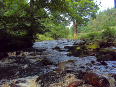
The small Cheshire hamlet of Gradbach is situated close to the border with Derbyshire and lies on the River Dane.
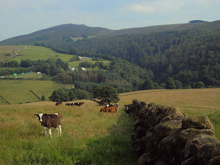
Left- Gradbach and the Black Forest and right the Youth Hostel at Gradbach
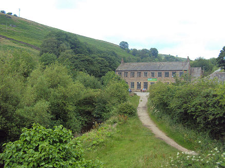
Gradbach is a well-known beauty spot which attracts many walkers. A stone-built silk spinning mill in the hamlet dates to 1785. Though the mill was water-powered and therefore cheap to run this was too remote a site for an enterprise like this to be commercially viable and the mill closed as early as 1885. It now serves as a Youth Hostel.
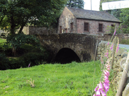
Gradbach Methodist Church on the banks of the River Dane and Lud's Church
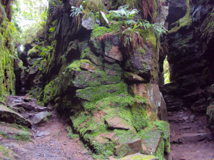
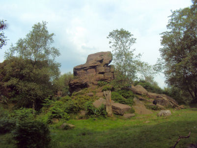
Nearby Lud's Church, otherwise known as Ludchurch, is a deep, dank chasm in the White Peak, situated in an area known as the Black Forest, towards the southwest fringe of the Peak District National Park. The cleft, which is 15 metres high in places and over 100 metres long, has been formed by a landslip which has detached a large section of rock. Over the centuries, Lud's Church has offered shelter to all sorts of fugitives, there are legends that both Robin Hood and Bonnie Prince Charlie used it.
Besides the Dane Valley, the area offers fine moorland walks on the Back Forest and the Gritstone Roaches (one of the UK's premier climbing destinations).
A walk to Ludchurch from Gradbach
Distance -around 3 miles
Duration The walk itself takes about an hour
*Commencing at the public car park on the way to the hamlet of Gradbach, turn right on exiting the car park and continue to the Youth Hostel, once an old mill.
*Walk downstream from the youth hostel to cross Black Brook, a tributary of the Dane, via a narrow footbridge.
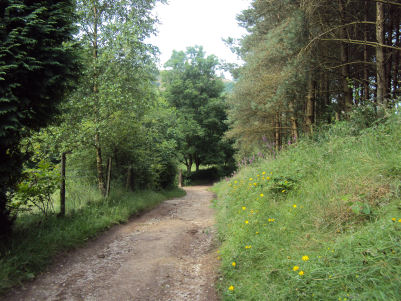
*Take the steep track through woodland to your right that leads uphill towards the vilage of Swythamley. On reaching the track halfway up the hill, turn right, following the sign for Lud's Church.
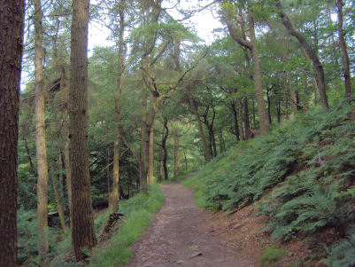
*Walk along the woodland track, passing some curious rock formations on the right, continue to follow the signposted track to to arrive at the ravine.
*Exit at the far end and follow the path back to entrance. Retrace your steps to return to Gradbach.
Follow the Country Code
*Be safe- plan ahead and follow any signs.
Protect plants and animals and take your litter home.
Keep dogs under close control
Leave gates and property as you found them
Nearby places of interest
Three Shires Head, is a beauty spot where the three counties of Derbyshire, Cheshire and Staffordshire meet.
Macclesfield Forest, once the centre of a Royal Forest created by the Norman kings for the purpose of hunting game such as deer, wild boar and wolves. It once encompassed all the area from Disley to the River Dane. The forest is home to a herd of red deer, while the reservoirs contain a wide variety of wildfowl.
Shutlingsloe is the third highest peak in the Cheshire (Shining Tor being the highest and Whetstone Ridge the second ) with an elevation of 506 metres (1,660 feet), the summit offers excellent views. On a clear day the mountains of North Wales are visible from its summit.