The Murder Stone
OS Grid ref:- SJ.984811
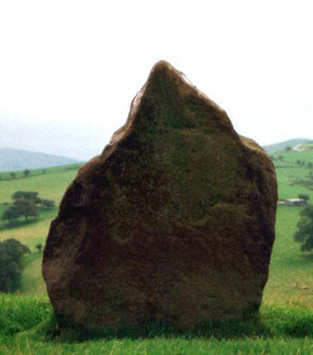 The prehistoric standing stone known as the Murder Stone is situated on a small hill about 300 yards west of Bailey's farm, which is around 3 miles to the west of Whaley Bridge in the Peak District National Park.
The stone is composed of millstone grit, measures 4 feet (1.3 metres) in height and is and is roughly diamond-shaped. It occupies a small hill set amongst rounded prehistoric mounds. Fine views may be had across the Goyt Valley to the south, and Lyme Park to the north-east.
The Murder Stone is reported to date to the Bronze Age and is a scheduled grade II listed ancient monument.
Directions
Take the B5470 and Macclesfield Road from Macclesfield to Whaley Bridge. Immediately after the hairpin bend turn left into Higher Lane, which skirts the base of Reed Hill. Continue along this lane, climbing a steep hill and turn right near the summit. Continue along the lane to reach Coldfield Farm.
Continuing on foot foot follow the track leading towards the farm buildings keeping left of them by the wood. Proceed along this track to reach the Murder Stone.