Raw Head
OS Grid Ref:- SJ508548
Raw Head, the summit of Bickerton Hill, rises to 227 metres and is the highest point on the Mid Cheshire Ridge and the highest point on the Sandstone Trail, a 55-kilometre (34 miles) long-distance walkers' path, which runs from the ancient market town of Frodsham to Whitchurch which lies just across the Shropshire border.
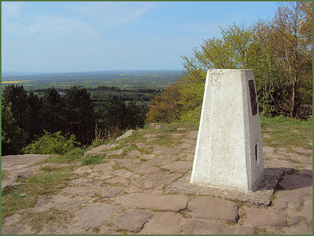
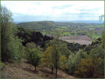
Extensive vistas over the Cheshire Plain unfold from the triangulation point encompassing, Chester, Liverpool, the River Mersey and the Clywydian Range mountains of North Wales. The area around Raw Head is a designated Site of Special Scientific Interest.
A walk to Raw Head from Higher Burwardsley
Distance -5 miles
Duration- around 2 hours
*Commencing from the lower car park at the Cheshire Candle Workshop (SJ521565), leave the car park, cross over the junction and follow Rock Lane uphill until reaching a Sandstone Trail signpost and gate leading off to the right. Cross fields, until arriving at a road. Continue up the hill along the road until reaching signpost to a track on the left.
*Ascend a set of stone steps and continue to follow the 'Sandstone Trail' markers, passing through a wood and farmland until arriving at Coppermines Lane. Cross over at the junction and follow the sign for Raw Head Farm. Ignoring the track to the farm itself.*
*Continue to follow the Sandstone Trail waymarkers until arriving at Raw Head triangulation point from where there are excellent views of the surrounding countryside.
*Retrace your steps to return.
Follow the Country Code
*Be safe- plan ahead and follow any signs.
Protect plants and animals and take your litter home.
Keep dogs under close control
Leave gates and property as you found them