White Coppice
OS Grid ref:- SD616190
Nestled below Great Hill on the edge of the West Pennine Moors, the charming Lancashire hamlet of White Coppice is situated around 3 miles to the north east of Chorley and lies to the north of Anglezarke Reservoir one of the Rivington Reservoirs which were built in the mid nineteenth century to provide water for Liverpool.
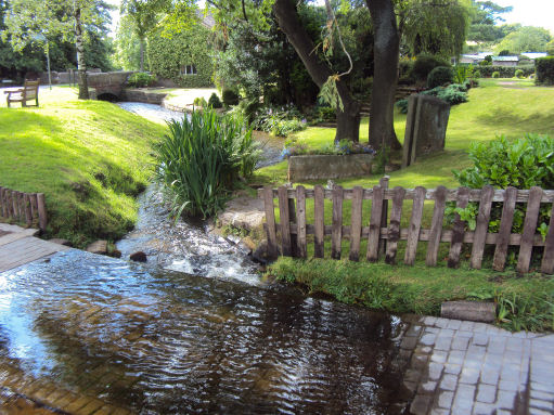
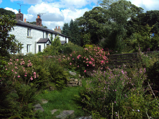
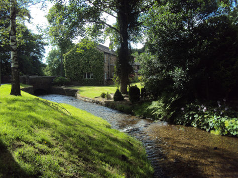
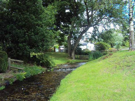
A small stream runs through the hamlet, with olde worlde cottages scattered around it. The Stones & Roses Garden at White Coppice Farm features a sunken rose garden, fountains, waterfalls, herbaceous borders, all with colour themed planting and is open to the public for charity on several days a year through the National Gardens Scheme.
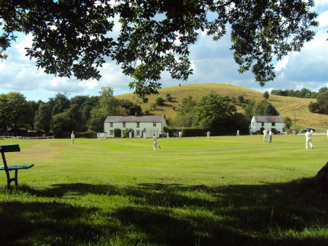
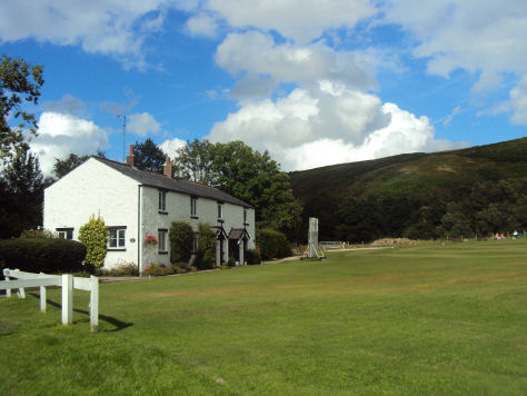
White Coppice had a cotton mill at the start of the Industrial Revolution. Its mill lodge provided water for a steam engine and before that the mill was powered by a waterwheel on the Black Brook. The hamlet boasts the most attractively set cricket ground in Lancashire . White Coppice is also the birthplace of Henry Tate in 1819 who funded the Tate Gallery on the banks of the Thames.
The Cricket Ground at White Coppice
Nearby Healey Nab or "The Nab" as it is known locally, is an area of countryside owned by Lancashire County Council containing rolling hills, moorland, woodland, ponds and streams and provides attractive walks. he name "Healey Nab" is derived from heagh (high) and ley (woodland). "Nab" is believed to derive from the Middle-English word nabb meaning a promontory or headland.
The area, which is criss-crossed with a network of hiking trails is very popular with walkers. There are two small man-made lakes, "Bottom Lodge" and "Top Lodge", a private fishing lake.
The summit is Grey Heights, and near it is a disused quarry known as "Devil's Rock". Grey Heights and its cairn at 682 feet form the highest point and from there are views over Chorley and it is possible to see the skyline of Preston, Fiddlers Ferry power station in Merseyside, the silhouette of Blackpool Tower and the Irish Sea. A mountain bike trail has been waymarked around Devil's Rock with trails winding through the woods from the summit to the lower slopes. There is also a bridleway.
Nearby places of interest
Rivington Country Park has woodland paths and moor side walks, which afford spectacular hilltop views of the surrounding countryside.
Tiger's Clough Waterfall situated on the River Douglas in a shady ravine on the Knollshaw Estate near Rivington.
Rufford Old Hall-Timber framed hall at Rufford near Ormskirk which dates back to the sixteenth century and is one of Lancashire's finest Tudor buildings.
Martin Mere -seasonally flooded wetlands attracts tens of thousands of migratory geese and wetlands birds making it one of the finest birding locations in the country.