Windgather Rocks
OS grid ref:- SJ994783
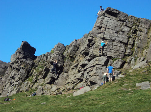
Windgather Rocks is a high viewpoint, on the Cheshire-Derbyshire border, situated around one mile south-east of the village of Kettleshulme, in the Peak District National Park. The gritstone escarpment forms the county boundary between Derbyshire and Cheshire and is a popular location for walkers and climbers.
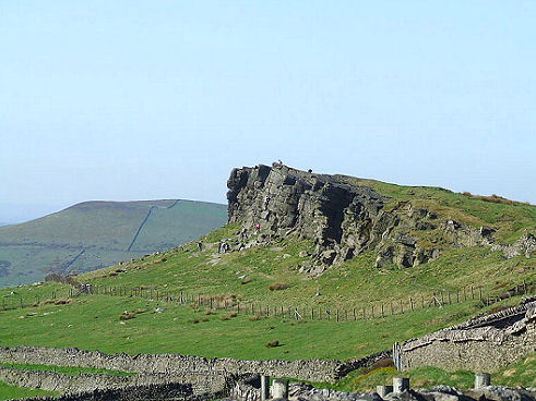
Views spread from the summit of the rocks across the Cheshire Plain with Manchester visible in the distance, the view to the east includes the lovely Goyt Valley. The outcrop is formed of Chatsworth Grits
Due to the unusual structures of the rocks, Windgather Rocks has been designated as a RIGS (Regionally Important Geological Site). During the Carboniferous Period (360-299 million years ago) the site that was to become Windgather Rocks lay over the Equator, these gritstones where laid down where an ancient river once met the sea at a huge delta.
A walk to Windgather Rocks from Errwood Reservoir
Distance- around 5.5 miles
. Commencing from the from Goyt Woodlands Car Park next to Errwood Reservoir proceed westwards uphill along 'The Street' to Pym Chair
. Take the footpath north to Windgather Rocks and descend eastwards following the footpath to Overton Hall Farm continuing past Madscar Farm.
. Turn south on the footpath towards Fernilee Reservoir, then take the footpath along the shore of Fernilee Reservoir to return to the car park
Follow the Country Code
*Be safe- plan ahead and follow any signs.
Protect plants and animals and take your litter home.
Keep dogs under close control
Leave gates and property as you found them