Longdendale
 The highly attractive Peak District valley of Longdendale lies to the north of Glossop.
The name means "long wooded valley". Longdendale stretches for ten miles, through a remote and rugged moorland landscape beneath the peaks of Shining Clough and Bleaklow, which rises to a height 2,077 feet (633 metres).
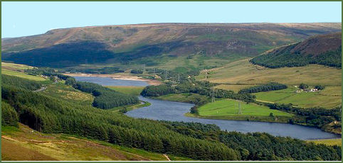
The valley has a chain of six reservoirs which are known as the Longdendale Chain and are Arnfield Reservoir, Bottoms Reservoir, Valehouse Reservoir, Rhodeswood Reservoir, Torside Reservoir and Woodhead Reservoir, through which the River Etherow (a tributary of the River Mersey) flows. The river rises at Holmfirth in Yorkshire. The reservoirs were completed in 1877 and were the largest artificial expanses of water in the world at that time.
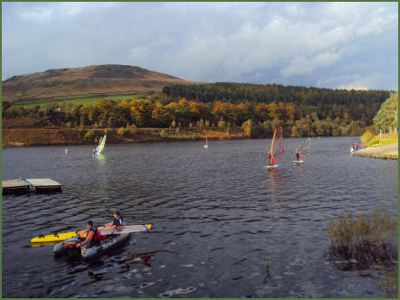
The top three reservoirs (Woodhead, Torside and Rhodeswood) and Arnfield are for drinking water, and the lower reservoirs (Valehouse and Bottoms) are used as compensation reservoirs to maintain the downstream flow of the river. There is a sailing club and picnic area at Torside reservoir and water skiing and fishing on Bottoms reservoir. There was originally a seventh reservoir, Hollingworth Reservoir, which was abandoned in 1990, and has now become part of the Swallows Wood nature reserve.
 Swallows Wood Nature Reserve covers 60-acres (0.24 km2) and consists of semi-natural woodlands, meadows, ponds and marsh areas, the reserve is owned by United Utilities.
The Longdendale Trail is a long distance trail which follows the route of an old railway line and the old packhorse route from Cheshire into Yorkshire. It runs for approximately 6.5 miles (10.4km) from Hadfield to Woodhead Tunnel. The trail follows the line of the former Manchester to Sheffield railway and is owned and managed by United Utilities. It forms the central section of the Trans-Pennine Trail which runs from Liverpool to Hull, a distance of 150 miles (240 kilometres). At Torrside crossing, the Pennine Way, Britains longest continual trail, crosses the Longdendale Trail.
The heather moorlands are carefullly managed, controlled burning of certain areas of heather creates varying habitats which are neccessary for red grouse and valuable to other species of moorland wildlife such as golden plover, merlin and ring ouzel.
The Longdendale valley has a developed a reputation for strange phenomena, including unexplained lights, making it a centre of attention for UFO and ghost hunters. It has, however, been suggested that the lights may be "earth lights" produced by pressure on the underlying rocks. Known as the Devils Bonfires to residents of the valley, the eerie flickering lights have been known for centuries, some believe their appearance has given rise to the name Shining Clough, one of the ridges where they are often reported as appearing. Age-old legends of the valley have attributed the lights to fairies, witches and even torch-bearing ghosts of Roman soldiers!
The evocative bubbling call of the curlew is a characteristic sound of the moors around Longdendale in the summer time. During the breeding season the male curlew performs aeriel displays above his territory. Short eared owls may also sometimes be seen on the moors, they have a distinctive pattern of flight, quartering the hillsides searching for prey, generally voles and mice. mountain hares find a home at the higher levels. Mountain hares are rare, other than Scotland, the Dark Peak is the only place in Britain which they now inhabit. In summer their fur is dusky brown in colour, but turns white in winter time to provid camoflague in the snow.
The artist Laurence Stephen Lowry, although born at Stretford, moved to Mottram-in Longdendale in 1948. The house where he lived, known as the 'The Elms' is located on Stalybridge Road in the village. He lived there until his death in 1976.
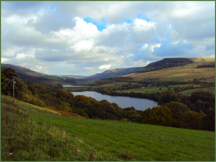
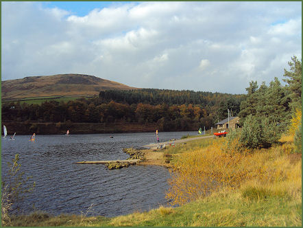
Torrside Reservoir
The Longdendale Valley has been inhabited for thousands of years, in the early twelfth century it became part of the Royal Forest of the Peak. In the later medieval period the valley was farmed by monks and most of the surviving woodland was cleared to provide grazing for sheep. In the present day, areas of natural woodland have been fenced to prevent grazing and to allow the natural regeneration of trees and shrubs. The North Peak, which includes Longdendale, is designated an Environmentally Sensitive Area, which encourages farmers to manage the land in a traditional way
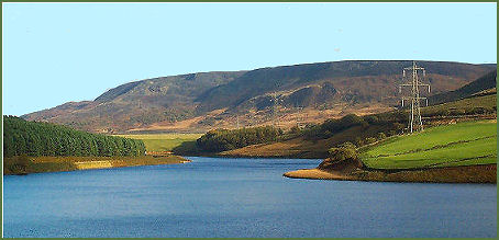
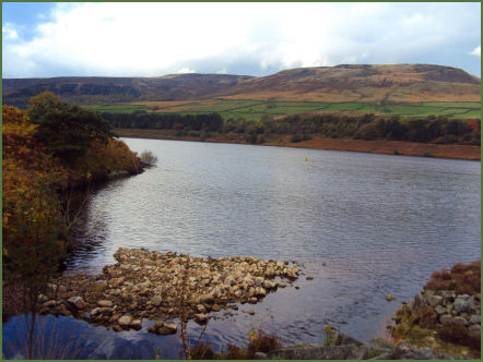
Left Torside and right Woodhead Reservoir
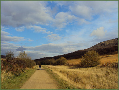
A walk at Torside Reservoir, Longdendale
Distance- 4 miles
 *Commencing at Torside Car Park on the B6105, proceed to the top of the car park and take the tarmac path winds uphill, passing through the Life for a Life Memorial Forest.
* On arriving at the Longdendale Trail, turn right and continue along the trail for around a mile, until reaching the B6105 road.
* From here follow the Pennine Way footpath a few yards up the road on the opposite side. Continue along this trail for around 30 yards, then turn left, following the the Pennine Way sign, and continue to reach Torside Reservoir.
* Cross the dam wall and as the road begins to veer to the left, go right at a finger post sign, ascending the steps. At the top of the steps turn right and follow the way through the wood.
.*Go over a stile, then turn right along the Torside Concessionary Footpath. to the banks of the reservoir.At the point where the track bends to the left towards the road, turn right following the sign for the Woodhead Dam.
*Go to the right crossing a bridge and continue up the road to reach the B6105. Cross over the road and follow the short path up to the Longdendale Trail.
*Turn right then right again through the Memorial Forest to return to the Torside car park