Lose Hill
OS Grid ref:- SK153854
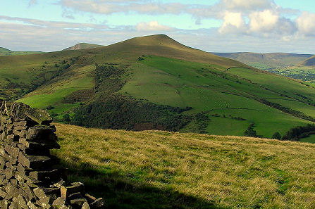 Lose Hill lies to the south-east of the village of Edale in the Peak District and forms the end of the Great Ridge that runs from Rushup Edge to the west over Mam Tor, Hollins Cross and Back Tor.
Lose Hill rises to 476 metres (1,562 feet) the views from the summit over Castleton and the Hope Valley are excellent. The hill is now in the ownership of the the National Trust.
Local legend states that Lose Hill derives its name from the Dark Age Battle Battle of Win Hill and Lose Hill which is said to have been fought there in 626 AD. The army of Prince Cwichelm and his father, Cynegils, King of Wessex, stationed on Lose Hill and probably aided by Penda, King of Mercia, advanced on the Northumbrians, who were based on nearby Win Hill.
The battle was long and fierce, any by the end the river Noe, which flows between the two hills, is reported to have ran red with blood. Despite having superior numbers, Cynegils forces were defeated by the Northumbrians who built a wall and rolled boulders down upon them. There is no record of this battle occuring in any contemporary Anglo-Saxon source.