Mam Tor
O.S. Grid Ref:- SK127836
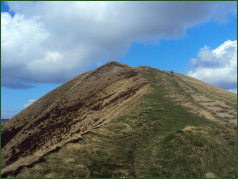
The distinctive, dome-shaped Mam Tor, near the summit of the limestone gorge of Winnat's Pass in the Peak District National Park, rises to a height of 517 metres (1,696 feet).
The name means Heights of the Mother, in Scottish Gaelic place names the name ‘Mam’ often appears as a place name element referring to rounded hills (e.g. the west Highland mountain range called the Mamores. The tor is also known as the Shivering Mountain because of its unstable lower shale layers.
At the base of the Tor and nearby are a number of caves: Blue John Cavern,Speedwell Cavern, Peak Cavern and Treak Cliff Cavern where lead, Blue John, fluorspar and other minerals were once mined.
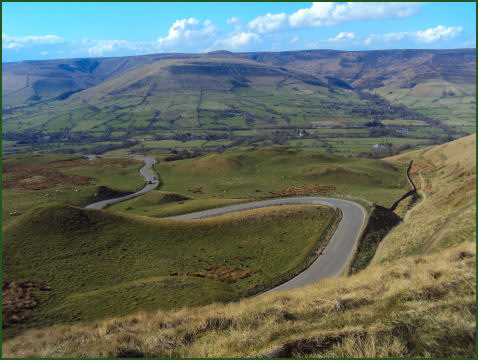
One of the distinguishing features of Mam Tor Peak is the active debris flow resulting from a rotational landslide that occurred roughly 4,000 years ago. The initial failure exposed bedrock displaying a sequence of shales and sandstones near to the summit. Evidence for the continued movement of the slide mass is demonstrated graphically by the continued severe damage to the old A625 road that traversed this flow.
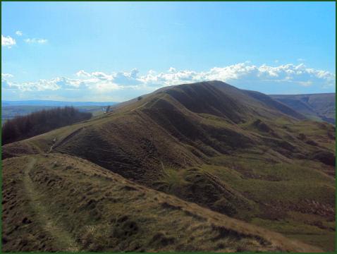
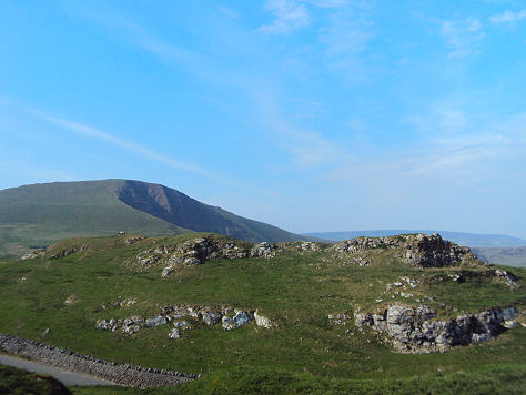
The views from the summit of Mam Tor are impressive, encompassing the Edale Valley and the dramatic plateau of Kinder Scout visible to the north and Castleton within the highly attractive Hope valley to the east with the ridge leading from the summit down to Hollins Cross and along to Lose Hill.
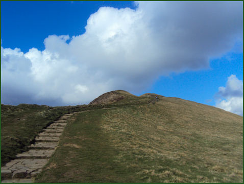
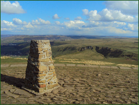
A large Iron Age Celtic fort once occupied the summit of the hill, the fortifications of which are still visible. The tongue shaped ramparts wind around much of the hilltop, enclosing an area of approximately 5 hectares (12 acres) and consist of a single rampart, outer ditch, and a further bank. There are clear remains of two gateways on the paths leading from Mam Nick and from Hollins Cross. The fort is the only one of the large hillforts in the Peak District to have been excavated. On either side of the main ridge the remains over 70 hut platforms were found. Excavations around and inside these huts revealed much broken pottery as well as whetstones and shale beads. The trig point which surmounts the summit stands on top of a tumulus which possibly dates from the Bronze Age.
A walk to the summit of Mam Tor
Distance- 1 mile
Duration 1 hour 45 minutes
*Commencing at the Mam Nick car park (OS grid reference SK123832), exit the car park via the top left-hand corner and proceed along the track up to the edge of the road at Mam Nick.
*Pass through the gate on your right and follow the surfaced path through the ancient ramparts of the Iron Age hill fort to the summit trig point
.*Retrace your steps to return to the car park.