Thorpe
OS Grid ref:-
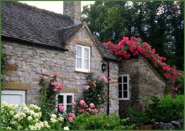
 The quaint Peak District village of Thorpe, literally at the gateway to Dovedale, is a popular tourist centre, set amidst stunning scenery on the east bank of the River Dove, it is situated about four miles to the north of the town of Ashbourne.
Lying at the foot of Thorpe Cloud, Thorpe makes is an excellent base for exploring nearby Dovedale, the Manifold Valley and the surrounding area of the White Peak.
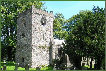
The village was founded in the ninth century, its name is of Norse origin and is the word for an outlying farm or hamlet. Thorpe was mentioned in the Domesday Survey of 1086 where it is recorded as being owned by the king. The village church of St. Leonard's (pictured left) has a squat Norman tower, constructed about 1100 AD, with fragments of Saxon stonework. The nave dates from the fourteenth century.
 The church boasts a superb Elizabethan altar rail and the fine tomb of John Millward, dating from 1632, in front of it are engravings of his 2 daughters dressed in gowns with embroided bodices and his 2 sons in cloaks and wide topped riding boots. Both the sons were soldiers, one a colonel in the service of King Charles I. The font, one of only three surviving Derbyshire `tub` fonts, dates from the eleventh century. Arrow sharpening grooves from the medieval era can be seen on either side of the porch doorway. In the fourteenth century villagers were encouraged to improve their archery skills and Sunday afternoon was set aside for practice.
The Peveril Of The Peak Hotel, The Dog and Partridge Country Inn and The Izaak Walton Hotel all provide accommodation and there are a number of guest houses in the village offering bed and breakfast accommodation.
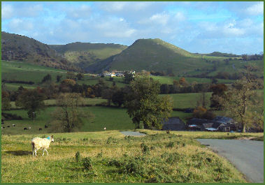 The conical hill of Thorpe Cloud, which rises to 287 metres (942 feet), stands sentinel with Bunster Hill at either side of the entrance to Dovedale. In common with much of Dovedale, including Bunster Hill, it is in the ownership of the National Trust. The name Cloud is a derivation of the Anglo-Saxon word "clud", meaning meaning a mass of rock. Thorpe Cloud is a poular and relatively easy climb, due to erosion, the National Trust prefer to direct visitors up particular routes. The easiest ascent is from Thorpe village along the ridge on the eastern side of the hill.
The ruins of Throwley Old Hall, a large medieval manor house and once the seat of the influential Meverall family, are situated a few kilometres to the north-west of the village. The hall was first recorded as a residence in 1203 when Oliver de Meverell settled here, the Meverell family remained in ownership of the hall until the mid seventeenth century. The house passed to Charles Cotton on his marriage to the widow of the last of the Meverells. In medieval times a village stood on the site, but it may have been abandoned before the Hall was built. It is now in the care of English Heritage.
Thorpe is situated on the Tissington Trail long distance footpath.
Nearby places of interest
Dovedale, a dramatic limestone ravine, with its mpressive rock outcrops and tranquil woodlands is arguably the prettiest of the dales in the Peak District National Park and is owned by the National Trust.
The Manifold Valley, which runs almost parallel with Dovedale, has been described as the 'Switzerland of Staffordshire' and offers some of the most spectacular scenery in the Peak District National Park.
Biddulph Grange, one of Britain's most exciting and unusual gardens, was created by the horticulturalist James Bateman (18111897), for his large collection of plants from around the world.
Haddon Hall near Bakewell, is an architectural gem. Dating back to the eleventh century, the hall has been described as "the most complete and most interesting house of [its] period", it is the finest example of a medieval manor house currently in existence in England.